【熱海豪雨】What Caused The Deadly Landslides in Atami?

Located about 100 km southwest of Central Tokyo, the resort area Atami in Shizuoka Prefecture was once popular for honeymooners. It is a seaside mountainous city, famous for hot springs.
At 10:30am on Saturday, torrential rain triggered mudslides, destroying numerous houses. Local media reports that two people were found without vital signs and nearly 20 people are missing. The Kise River has swollen, sweeping one house away and collapsing a big bridge downstream. In the nearby city of Zushi in Kanagawa Prefecture, a moving car was engulfed by a landslide on a major road. The driver was injured. The shinkansen bullet trains were suspended in the morning, and the Tomei expressway linking Tokyo and Nagoya have been partially shut down.
Professor Susumu Yasuda of Tokyo Denki University told Degital Asahi that as Atami has a volcano nearby, ashes and debris on the ground makes the area susceptible to landslides.
How much rain has fallen?
Central Japan is currently in the latter part of the summer rainy season called Tsuyu. It’s the time of the year when Japan is hit by floods and landslides, however the rainfall amount this time was unprecedented.
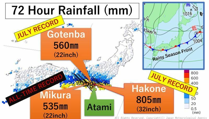
Atami has recorded 410 mm of rain in 72 hours from Thursday to Saturday, which is 1.7 times more than the average June rainfall. Hakone in Kanagawa Prefecture, located near Atami, has seen 805mm of rain in 72 hours, surpassing the previous June record of 428mm. Mikura in Shizuoka Prefecture had 535mm of rain, making it the all-time record.
The heavy rain was triggered by an active rainy season front which has been sitting over the south coasts of central Japan for days. Earlier this week, the front hovered around Southern Japan’s Okinawa, dumping record-breaking heavy rain, opening a sinkhole on a road.
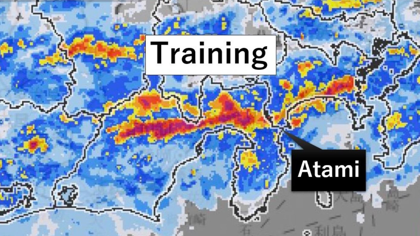
Extremely moist air from the Pacific Ocean flowed into Shizuoka Prefecture on Saturday, creating a stalled linear rain band called training.

Rainfall forecast
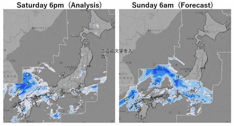
As of Saturday afternoon, rain has eased in Shizuoka Prefecture and other parts of Central Japan. However, a chance of heavy rain at times will likely remain into next week with an additional 130mm expected from Saturday evening to Monday evening. The record rain has loosed the ground, so more rain could trigger disasters. Extra caution is necessary.

5-Level Disaster Scale
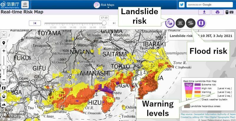
Japan has a five-level disaster warning scale. If Level 3 is in effect in your area, the elderly and people who need assistance must start evacuating. If a Level 4 is in place, everyone is required to move to safe places immediately. Level 5 is the stage when people should make every effort to save themselves as disaster might have already happened at that point.
According to the Shizuoka Asahi TV, evacuation orders, equivalent to the level 4, were issued for 360,000 people in Shizuoka Prefecture. However only 26 people used shelters provided by local governments.


