Hazardous Rainband to Impact Western Japan

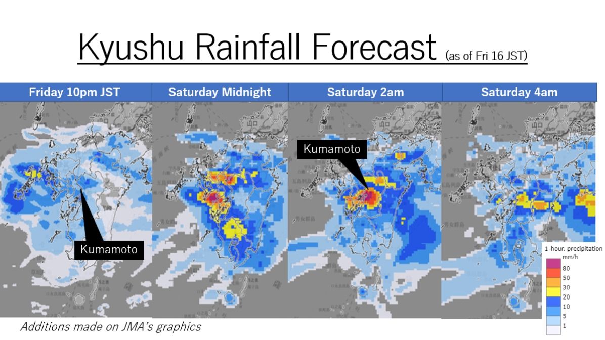
After record-setting brutal heat, Japan is now experiencing a rainy whiplash. A wet season front, which disappeared abruptly last month, is now returning to the nation, causing flooding rains. Authorities are warning that the rain is expected to intensify from Friday night to Saturday morning with the possibility of an emergence of dangerous rainbands called senjo-kosuitai.
Rainfall Record
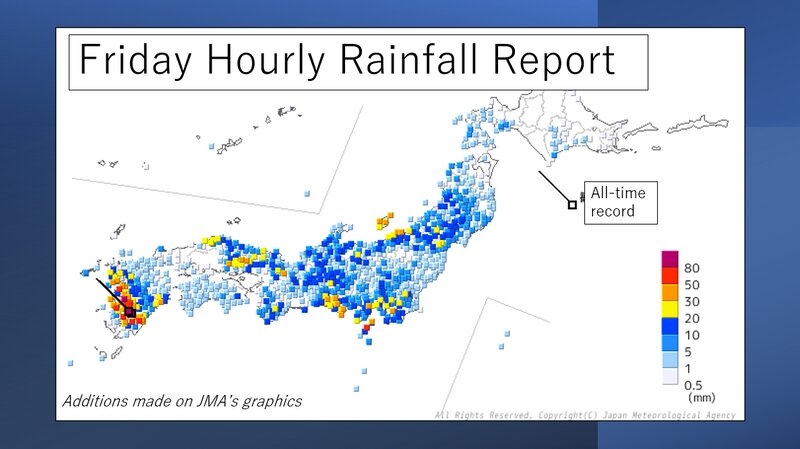
Torrential rains have been battering Western Japan on Friday. Ebino City in Miyazaki Prefecture had 94mm of rain in the space of only one hour in the morning, making it the all-time record for hourly rainfall. Kobayashi City in the same prefecture had a record-whopping 168mm of rain in 3 hours, and 215mm in 6 hours, which is almost half its July monthly rainfall.

Vicious Linear Rainbands
The Japan Meteorological Agency (JMA) is warning that the Kyushu region and Yamaguchi Prefecture could experince dangerously heavy rainfall from Friday night to Saturday morning as vicious narrow rainbands called senjo-kousutai, which literally means "linear rainband" in Japanese, could develop. Senjo-kosuitai are repeated areas of rain that drift over the same area for several hours. It is known as "training" in the US, but the JMA defines it as a rainband 50 to 300km long and 20 to 50km wide. Historically, the phenomenon caused deadly flooding and landslides in the warmer seasons in Japan.
Rain forecast
The JMA is forecasting that torrential rains will return to Kyushu and Yamaguchi Prefecture on Friday night and continue into Saturday morning. The ground has loosened, so additional rain will raise the possibilities of floods and landslides.
Moreover, weather will be unstable nationwide into Sunday due to cold air aloft and humid air in the lower atmosphere. Stay vigilant against thunderstorms and heavy downpours.
Information Links in English
To get information regarding the weather conditions in English, the links below might be helpful:


